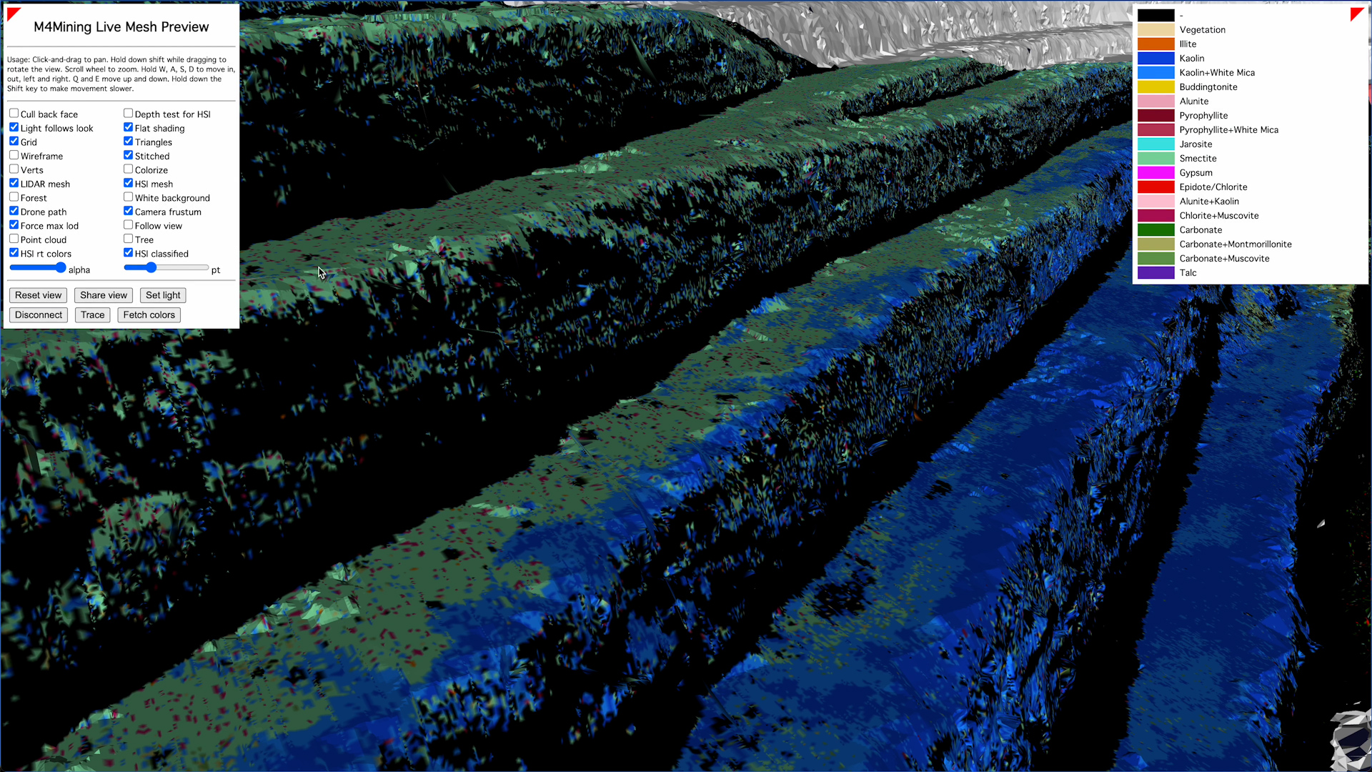
Breaking ground for mining and more industries, a European collaboration has developed integrated hardware and software that enables simultaneous hyperspectral data collection and analysis. This will transform research for anyone using hyperspectral imaging and data, drones, or remote sensing technologies – with instant processing and analysis done as data is collected.
The collaborators are HySpex by NEO (Norsk Elektro Optik), NORCE Norwegian Research Centre, ReSe Applications LLC, and Prediktera AB – which all made incremental innovations on IP to achieve the result.
Imagine a drone collecting hyperspectral data at 500MB per second while, in real time, Hyspex’s integrated system will instantly and accurately:
- Generate surface models
- Geo-reference hyperspectral data
- Perform atmospheric corrections
- Run application-specific analyses (mineral maps)
- Visualise everything in 3D on the ground station as a mesh
Technical Director of Raymax Applications which distributes Hyspex in Australasia Dr Cedric Chaminade believes there’s a huge bonus for end-users, thanks to the elimination of rasterisation and unnecessary overheads with data post-processing.
“This major development in integration creates a turnkey solution that delivers accurate results instantly,” says Cedric.
“Anyone using this integrated system would benefit from the highest data quality captured by Hyspex hyperspectral imaging systems and from the way it democratises remote sensing by combining hyperspectral imaging, direct geo-referencing and data analysis – all in real time and in flight.”

Images taken by a drone over Greece and shown as seen simultaneously at the ground station in Norway via satellite.
Hyspex sees the potential as virtually limitless and identifies most obvious applications as:
- Agriculture: Precision crop monitoring and management
- Forestry: Immediate detection of forest health or damage
- Environmental Monitoring: Real-time tracking of pollution or climate changes
- Defence: Rapid situational awareness and decision-making
The Hyspex team is grateful to its partners in the m4mining group’s Horizon Europe project, and to the European Commission for funding m4mining. This group aims to improve material characterisation during exploration, extraction, re-mining, and environmental impact monitoring through real-time mineral classification via UAV, giving seamless 3D visualisation to decision-makers.
HySpex distributor Raymax has more than three decades’ experience customising and proving results with lasers and photonics equipment in Australasia. Call the Raymax experts to discuss your imaging needs on (+61 2) 9979 7646 or see HySpex at Raymax.
